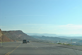
Cedar City to Zion National Park
A friend suggested I include a map - the 1st days trip from Kansas to Frisco is not included. The 2nd day is the marked red line on the top. I-70 until it ends, then Highway 15 to Cedar City, which is circled on the top left.
After a night's rest at Cedar City, we drove to Zion National Park. We were going to turn off at the Toquerville exit, but the 2nd exit (highway 9) wasn't that much out of the way and was marked as scenic. Well, not so much. The town of Hurricane is built up all the way, so if anyone wants to take this path, just take the short-cut.
The bottom circle on the left is Zion National Park, which was our destination.
When we got to Zion, it was pretty easy to navigate. The entrance fee is $25 and you have to park in the parking lot. They do not allow any cars into the park past the parking lot. There just wouldn't be room with the volume of visitors they have. LOTS! We heard lots and lots of languages - Chinese, French, German, Spanish, British English, Australian and I don't know what all. I did not hear any Japanese though. Quite unusual.
We were a little confused before we parked as to what to do. But it really was explained well after you walked up to the shuttle parking area. They show you all the different trails you can take, from easy to difficult. We picked out 3 different trails we would like to do, picked up a map and boarded the shuttle.

We got off at the "shuttle stops" that were called out and took off on our trails. On our first trail, we came across a family of deer.
This trail was easy - infact, there were many families, some with strollers. Even wheelchairs can be pushed on this trail.
Can you see that speck on the notch in the rock? This guy is obviously taking a difficult trail!!
 The pharmacy at Newton Med has a weasel as a mascot. A long time ago, some nurses called the pharmacists weasels so one of the guys got this weasel and they named him Lortab. Lortab has his own Facebook page! Look him up! Lortab has traveled all around the world. Anyone from the hospital who is travelling can ask to take him with them. He has been to the Vatican, to South America, and all over.
Well, we brought him with us on this trip. We happened to see a squirrel sunning himself on a rock, so Al placed Lortab beside him.
It didn't take too long, until the squirrel came to investigate.
But then, he began to remove ("steal") Lortab's hat so Al had to run in to the rescue!
Lortab was grateful.
By the way, it was Allen's birthday on this day! 57!! Woot, woot!!
"Hanging gardens" on the rocks.
We spent about 3 hours here and could have spent more for sure, but we needed to get on.
We got into our car to leave Zion.
The road was very, very windy! Much like a roller coaster. I thought of Staci, Jill and Julie who all get so very car sick. They would just puke! Look at the photo! (I found this on-line since I couldn't take a picture to really show how curvy it was) It is very scary, but I am sure some find it thrilling!
We weren't sure at first what this hole was, but then we entered a tunnel.
Al said with the tunnel so very long, they probably need these "windows" (there were several) as air vents for the car exhaust.
Here is some information I found:
Here is a picture of them working on the tunnel.

I'll continue Day 3 about Bryce Canyon next.


fantastic trip, great photos. i'm a tad jealous, but really grateful for the view you have given us.
ReplyDelete