Before leaving Josh and Staci's, we looked at our atlas. What roads had we not been on before? We highlight roads we've been on in yellow. We made a decision and took off.
We hadn't been through Tontitown on our way out of Josh's for awhile and was surprised that the church was no longer there - just the steeple. Evidently, deterioration forced them to take it down.
412 to Siloam Springs where Josh and Staci met, at John Brown University. We've been on this highway many times.
We noticed that Siloam has a Whataburger! We had to go past our turn off just a little bit.
We ordered a burger and onion rings. We had them cut the burger in half so we could split it as we weren't that hungry. We thought it was kind of pricey. But it was delicious!
We backtracked to Highway 59 and headed north to Gentry. And from there we went west on 116. It was kind of confusing, because the map had 116, but in Arkansas it was named Highway 12. We went too far north and had to turn back.
I have friends who would love this place! It is right at the Arkansas/Oklahoma border on 116.
We had gone to early service at Josh's. We passed many small churches that were still in session, celebrating Palm Sunday.
This church had cow skulls on the banister!

The road was mighty curvy.


412 Alternate - beautiful country!
We could smell smoke and it was a little concerning as it was windy.
We saw some smoke but luckily we drove out of it. Further on, we saw that there had been a fire here. The dirt was blackened and some trees damaged.
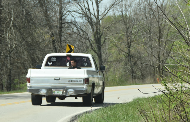
A guy was hitching a ride in the back of the pickup.

Lake Hudson
At Salina, there had been some flooding. We stopped at a gas station and they said that some homes were flooded. They had had several days of rain.
I marked our atlas as we went. A week earlier, there had been a tornado sweep passed Owasso. A fellow school mate of mine from Japan lives 1 mile from where that tornado hit. We wanted to visit her, but she wasn't home.
At Claremore, we took 169 north for a short distance, and continued on Highway 20.
We were in Osage Nation.

We pulled off to see Skiatook Lake.
Hominy was home of an All-Native American football team in the 1920's. The Hominy Indians beat the New York Giants in 1927.
More fires had swept through here.
"Due to Ralston's close proximity to the Osage Reservation, where liquor was banned, saloonkeepers derived a thriving business before 1907 statehood and prohibition. In 1903 seven saloons operated on Main Avenue."
Do we turn? Or go straight?
Straight, of course!
We took an undesignated road into Ponca City.
Maps said "Continue on 9 mile road for 5 miles."
The Salt Fork Arkansas River
In Kansas, we pronounce this Ar-Kansas.
Took Highway 60 into Ponca City.
In Ponca City, there is a mansion called the Marland Mansion that we would love to go see sometime. It is not open on Sundays, so we will need to do this another time.
We took 177 north.
Blackwell, Oklahoma. We always see the outlet mall from I-35 when we are on the turnpike, but I'd never been through town before. Al said when he was in highschool and custom cut for a farmer from Pretty Prairie, they stopped here to purchase a chisel plow.
Old gas station
We went through a little town called Braman.
We saw a sign that Braman was the home of Kasie Head. Who? I looked it up. She was Miss Oklahoma in 2002.
Bridge out.
We decided to hop on I-35 at this point and headed home.
We were able to highlight more new roads that we had never adventured on before!
It is always such fun to see parts of America that normally would be missed by taking interstates and state highways.


